India’s agricultural sector could be approaching a major digital transformation, with experts comparing the emerging AgriStack system to the revolution brought about by the Unified Payments Interface (UPI) in digital payments.
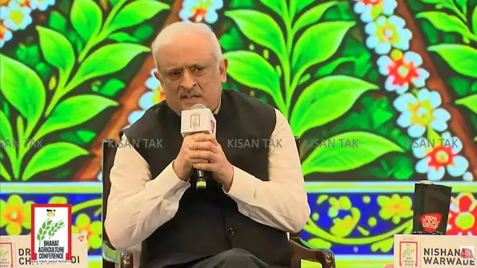
At the India Today Group’s Kisan Tak Bharat Agriculture Conference, government officials and industry representatives discussed how Artificial Intelligence (AI), digital farmer records and location-based information could change the way farming is managed across the country.
Dr Devesh Chaturvedi, an IAS officer who has been associated with the development of AgriStack, described the platform as a potential next-generation digital infrastructure for agriculture. He said the system could help connect information about farmers, their land, crops and local agricultural conditions with Technology-based services.
AgriStack was launched in 2024 as part of the government’s Digital Agriculture Mission. Its central objective is to create a connected digital framework for agricultural information, making it easier to identify farmers and their plots and support the delivery of relevant services.
The proposed transformation is not simply about putting agricultural records online. It is about using reliable information to help governments, service providers and farmers make decisions based on what is happening in individual fields.
What is AgriStack and why is it being compared with UPI?
AgriStack is a digital public infrastructure initiative designed to bring together important agricultural information through a common digital framework. It is intended to create digital identities for farmers, maintain records of agricultural land and support the digital mapping of crops.
The comparison with UPI comes from the idea of building a shared digital foundation that different services can use. UPI made it possible for banks, payment applications and users to transact through a common interoperable system. AgriStack aims to provide a similar foundation for agricultural services by making farmer and farm-related information more accessible through digital systems, subject to appropriate consent and safeguards.
For example, a farmer’s digital record could help establish which land they cultivate, what crops are grown there and which agricultural services may be relevant. This information could support more targeted delivery of government schemes, crop-related advisories and other services.
However, agriculture is more complex than digital payments. Farming decisions depend on local weather, soil conditions, water availability, crop varieties, market conditions and changing environmental factors. A digital identity system alone cannot solve these challenges. Its value will depend on the accuracy of its underlying records and how effectively those records are converted into useful services.
AgriStack has three key layers: Farm Registry, Farmer ID and crop surveys
Chaturvedi explained that AgriStack is built around three important components: the Farm Registry, the Farmer ID system and digital crop surveys. Together, these layers are intended to connect farmers with the land they cultivate and the crops grown on it.
1. Farm Registry creates digital records of agricultural plots
The first component is the Farm Registry, also described at the conference as the Map Registry. It focuses on identifying and digitally recording agricultural plots.
According to Chaturvedi, the system uses field information maintained by state Revenue Departments. Each identified field is associated with a field number, which forms the basis of its digital identification.
This information is important because agricultural land records can be fragmented across different locations and administrative systems. A digital farm record can help establish the location and identity of a plot, making it easier to connect land-related information with agricultural services.
The system also uses georeferencing, which connects a plot’s record with its geographical location. This can help government agencies and technology platforms understand where a particular field is situated rather than relying only on a farmer’s general address or manually supplied description.
Accurate mapping can support crop monitoring, agricultural planning and the delivery of location-specific advisories. It can also help authorities build a clearer picture of farming activity across districts and states.
2. Farmer ID gives cultivators a unique digital identity
The second layer is the Farmer ID system. Chaturvedi said the platform assigns an 11-digit unique identification number to a farmer, drawing a comparison with Aadhaar.
The Farmer ID is intended to connect a farmer’s identity with relevant agricultural information. According to Chaturvedi’s explanation, the system’s backend can include details such as Aadhaar-linked information, mobile number, the plots associated with the farmer and the farmer’s share in a plot where land is cultivated or held by multiple people.
This connection can be useful in situations where a single agricultural plot is associated with more than one farmer. Instead of treating the entire field as belonging to one individual, the system can record the relevant information about different farmers and their respective shares.
Such records could help improve the identification of beneficiaries for agricultural schemes and reduce confusion when services depend on establishing a farmer’s connection with a particular plot.
Chaturvedi also said farmers could provide consent to share information associated with their Farmer IDs with other farmers. Consent-based access is an important part of the system because agricultural records can contain personal and land-related information that should not be treated as universally accessible.
3. Digital crop surveys record what is being cultivated
The third component involves digital surveys of crops. While farm records establish where agricultural plots are located and Farmer IDs identify cultivators, crop surveys add information about what is being grown in those fields.
Chaturvedi described a process in which a surveyor must physically reach the field before completing a survey through an application. The surveyor opens the app at the location, takes a photograph and records the crop that has been planted.
This approach is intended to connect crop information with the actual geographical location of the field. It can help make agricultural records more closely reflect cultivation activity rather than relying entirely on information submitted remotely.
He also highlighted the possibility of using satellite technology to make crop identification and monitoring easier. Satellite-based information can provide a wider view of agricultural land and may help authorities monitor changes across large areas.
Combining field-level surveys with satellite-based information could strengthen the quality and coverage of crop records. However, the usefulness of the data will depend on survey accuracy, timely updates and the ability to identify crops correctly under different conditions.
Government reports 11 crore Farmer IDs and 30 crore digitally surveyed plots
Chaturvedi said the government had created 11 crore Farmer IDs and digitally surveyed 30 crore plots. These figures indicate the scale at which the digital agriculture initiative is being developed.
The two numbers represent different parts of the system. Farmer IDs are intended to identify individual farmers, while digitally surveyed plots provide information about agricultural land and cultivation locations.
Building these records at a national scale could give government departments a more structured understanding of farming activity. It may also make it easier to connect agricultural programmes with the people and locations they are designed to serve.
However, the number of digital records created is only one measure of progress. Their long-term value will depend on whether the information remains accurate, whether farmers can access and correct relevant records, and whether digital services produce practical benefits at the field level.
How Bharat Vista and AI could turn farm data into useful advice
One of the most important possibilities discussed at the conference was the combination of AgriStack with Bharat Vista, an AI platform launched by the Union government.
Chaturvedi explained that a farmer could provide location-related information and use the AI platform to obtain information such as weather conditions over the coming week or details about a crop’s rate. He said linking the AI platform with AgriStack could make the information more specific to an individual farmer’s circumstances.
AgriStack can provide information about the farmer’s land location, cultivated crop and agro-climatic zone, along with soil-health-related details where available. An AI platform can use relevant information to generate more targeted agricultural guidance.
For example, an advisory about irrigation could become more useful if it considers the farmer’s location, crop and local conditions rather than offering the same recommendation to everyone. Instead of receiving a broad message about watering, a farmer could potentially receive guidance on when irrigation may be appropriate for the particular crop and area.
This is where the combination of digital records and AI becomes significant. AgriStack is intended to help organise information about farms and farmers, while AI tools can help interpret relevant data and present it in a form that supports decisions.
Such technology could also help make agricultural advisories more location-specific. Weather information, crop conditions and soil-related data can vary significantly between regions, and a system that accounts for these differences may be more useful than generic recommendations.
Still, AI-generated advice should not be treated as automatically accurate. Its reliability depends on the quality and freshness of the underlying information, the performance of the model and whether recommendations account for local farming conditions. Farmers may also need support from agricultural experts when decisions involve significant costs or risks.
Madhya Pradesh says it has achieved full Farmer ID and georeferencing compliance
Nishant Warwade, Secretary of Agriculture in the Madhya Pradesh government, said the state was already seeing benefits from the digital agriculture framework.
Warwade described Madhya Pradesh as a 100 per cent Farmer ID-compliant and 100 per cent georeference-compliant state. He also said that government schemes in the state had been digitised.
The state’s experience illustrates how digital agricultural infrastructure can be integrated into government administration. When farmer identities and land information are available through digital systems, departments may be better positioned to identify eligible beneficiaries and manage scheme-related information.
Digitisation can also reduce dependence on disconnected records and manual processes. However, the practical impact depends on how well different departments use the information and whether farmers can access services without facing additional technical or administrative barriers.
Warwade’s comments suggest that Madhya Pradesh is using digital systems as part of a wider administrative approach rather than limiting them to the creation of farmer identities.
Why georeferenced farm data matters for speed, scale and accuracy
Roli Jindal, co-founder and CEO of RSMI Cropalytics, highlighted three potential benefits of digitising agricultural information: speed, scale and accuracy.
She argued that technology could make monitoring more economical, particularly when the value of the crop is considered against the cost of inspecting it. Jindal illustrated this with an example of a field containing a crop worth Rs 4 lakh, saying that its monitoring cost should be proportionate to the value being monitored rather than becoming excessively expensive.
Her point was that traditional monitoring methods can become costly when applied across large agricultural areas. Digital mapping and georeferenced information could help organisations monitor fields more efficiently and reduce the cost of collecting information.
Scale is another important factor. India has millions of farmers spread across different geographical and climatic conditions. Monitoring every field through repeated physical visits can be difficult and resource-intensive. Digital records and technology-assisted monitoring may help authorities and service providers cover larger areas.
Accuracy is equally important. Jindal said that when crop damage occurs in a remote part of the country, decision-makers may otherwise take a long time to receive information. She argued that georeferenced data and technology could help machines understand field conditions and improve the speed with which information reaches the relevant authorities.
Faster information can be useful for several agricultural activities, including crop monitoring, damage assessment and planning. It may also help government departments identify where intervention is required without waiting for information to move through multiple manual channels.
However, digital monitoring cannot eliminate every delay. The quality of the results still depends on accurate field data, timely updates, reliable connectivity and the ability of authorities to act on the information they receive.
Can AI and digital surveys improve crop-loss monitoring?
Crop damage can create financial difficulties for farmers, particularly when information about the affected area reaches authorities late. Timely assessment is important for understanding the extent of damage and determining what assistance may be required.
Jindal’s comments highlighted how georeferenced agricultural information could help reduce the time between an event affecting a crop and decision-makers becoming aware of it.
When field boundaries, crop details and geographical information are digitally recorded, authorities may have a stronger starting point for identifying affected areas. Satellite imagery and other technology-based monitoring tools could add further information about changes in crop conditions.
Such systems may support faster assessment, but they do not automatically establish the full extent of a farmer’s loss. Field verification, reliable evidence and the applicable assessment procedures may still be necessary, depending on the purpose of the evaluation.
The broader opportunity is to combine different sources of information so that agricultural monitoring becomes more systematic and less dependent on delayed reporting.
Social media influencers could become a bridge between technology and farmers
While digital infrastructure and AI tools are expanding the government’s ability to collect and process agricultural information, experts at the conference also stressed the importance of communicating useful information to farmers.
Social media influencer Pargat Singh said agricultural influencers could act as a link between government information, farming knowledge and rural communities. He argued that influencers could help distribute information about crops, farming practices, government policies and agricultural advisories to a large audience in a short time.
The point is significant because developing a digital platform does not necessarily mean that farmers will know how to use it or understand the information it provides. New technology needs to be accompanied by effective communication, demonstrations and practical guidance.
Farmers may need information about how to register for digital services, access their records, understand AI-generated recommendations and identify relevant government schemes. Social media creators who understand agricultural issues and communicate in familiar languages could help make such information easier to access.
However, the role of influencers also creates a need for responsible communication. Agricultural information can affect decisions involving crops, irrigation, fertilisers and finances. Incorrect or unverified advice could therefore cause harm. The credibility of the person sharing information and the accuracy of the content remain important.
Madhya Pradesh government is using AI tools to create social media content
Warwade said the Madhya Pradesh government had already adopted social media as part of its communication strategy. He explained that the state’s public relations department had created digital influencer teams that produce four to five information flyers each day using AI tools.
According to Warwade, the content is created by young people who are familiar with social media platforms and technology. The approach is intended to make government communication more suited to the way people consume information online.
Regular digital content can help publicise agricultural schemes, share updates and circulate information about farming-related initiatives. It can also give departments another channel through which to communicate with farmers beyond traditional announcements and administrative notices.
AI tools can assist with preparing visual material and adapting information for digital platforms. But the use of these tools does not remove the need for human review. Government communication must remain accurate, understandable and consistent with official policies.
The Madhya Pradesh example also highlights a broader shift in agricultural communication: technology is being used not only to manage farm data but also to distribute information about government services and farming practices.
What an AI-powered agricultural system could mean for farmers
If digital records, geospatial information and AI-based services work together effectively, farmers could benefit in several areas. The potential advantages discussed at the conference include:
- More targeted advisories: Location, crop and soil-related information could help generate guidance suited to a farmer’s local conditions.
- Improved access to schemes: Digital farmer identities could help government departments organise beneficiary records and manage agricultural programmes.
- Faster crop monitoring: Digital surveys and satellite-based information could help authorities track cultivation across larger areas.
- Better irrigation guidance: AI systems could use available crop and location information to support more specific irrigation recommendations.
- More efficient damage assessment: Georeferenced records could help identify affected agricultural areas and support the assessment process.
- Wider information access: Social media and digital communication channels could help distribute agricultural advisories and scheme-related information.
These benefits are possibilities rather than guaranteed outcomes. Their effectiveness will depend on the quality of data, the accessibility of digital services and whether the information is useful in real farming conditions.
Challenges that India must address in digital agriculture
Despite the potential of AgriStack and AI, building a nationwide digital agriculture system involves challenges that cannot be solved through technology alone.
Accuracy of land and farmer records: Digital systems are only as reliable as the information they contain. Errors in land records, farmer identities or plot mapping could affect the services connected to them. Mechanisms for correcting inaccurate records will therefore be important.
Consent and data protection: Farmer IDs may connect personal information with land and cultivation details. Farmers need clear information about how their data is used, who can access it and how consent can be managed. Safeguards against unauthorised access are essential for maintaining trust.
Digital access and awareness: Not every farmer has the same access to smartphones, reliable internet connectivity or digital literacy. Services that work well for digitally connected farmers may be difficult to use in areas with limited connectivity or technical support.
Quality of AI recommendations: AI systems need accurate and updated information to generate useful guidance. Weather, soil conditions and crop requirements can change, and recommendations must account for local variations. Human agricultural expertise will remain important.
Coordination between states and departments: Agriculture involves multiple government departments and state-level systems. Consistent records, compatible technology and clear administrative responsibilities will be necessary for a nationwide framework to function effectively.
Addressing these issues will determine whether digital agriculture becomes a practical support system for farmers or remains primarily an administrative data initiative.
How AgriStack could reshape India’s agricultural future
The discussion at the Kisan Tak Bharat Agriculture Conference highlighted a shift in how technology is being considered in Indian agriculture. Instead of treating digital tools as separate applications, the emerging approach is to connect farmer identities, land records, crop information and AI-based services through a shared digital framework.
AgriStack provides the proposed foundation for organising information about farmers and their fields. Bharat Vista and other AI-enabled services could potentially use relevant information to offer more specific guidance. State-level digitisation and social media communication could help connect these systems with government programmes and farmers.
The comparison with UPI captures the ambition behind this approach: creating digital infrastructure that can support multiple services rather than building isolated systems for individual purposes. But agriculture has its own complexities, and the success of this transformation will depend on more than the number of IDs created or plots mapped.
For farmers, the real test will be whether the technology helps them make better decisions, access government support more easily, monitor crop conditions and respond to changing weather and agricultural challenges.
India’s digital agriculture initiative is still developing, but the scale of the Farmer ID and plot-survey figures shared at the conference indicates the extent of the ongoing effort. If accurate data, accessible services and responsible AI use come together, AgriStack could become an important part of India’s agricultural infrastructure.
For breaking news and live news updates, like us on Facebook or follow us on Twitter and Instagram. Read more on Latest Technology on thefoxdaily.com.






COMMENTS 0