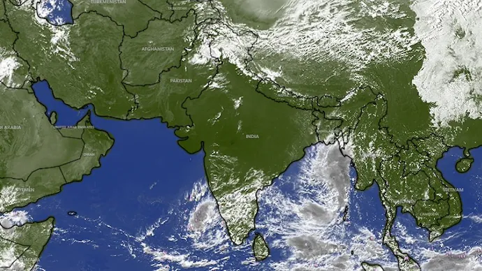
A depression over the Bay of Bengal is forecast to intensify into a very severe cyclonic storm before crossing the Andhra Pradesh and Yanam coasts on October 28, prompting authorities to step up preparations, issue warnings to fishermen and alert residents in vulnerable areas.
The India Meteorological Department (IMD) said the weather system, which intensified from a low-pressure area into a depression on Saturday, is expected to strengthen in stages over the coming days. The forecast indicates that the system could develop into a cyclonic storm by October 26, become a severe cyclonic storm around October 27 and intensify further before reaching the Andhra Pradesh coast.
The storm is forecast to cross the coast between Bapatla and Visakhapatnam by late morning on October 28, with sustained wind speeds of 115 to 125 kmph and gusts reaching up to 140 kmph. The IMD has also warned of heavy to very heavy rainfall, with extremely heavy rain possible at isolated locations in coastal Andhra Pradesh and Yanam.
Andhra Pradesh Chief Minister N Chandrababu Naidu has directed officials to remain vigilant, take precautionary measures and alert people living in low-lying areas. Meanwhile, the Fisheries Department has been monitoring fishing boats returning to shore, with authorities prioritising the safety of fishermen and their equipment.
Bay of Bengal Depression: Latest Location and Movement Forecast
According to the IMD, the depression was located over the east-central and adjoining southeast Bay of Bengal at 5.30 pm on Saturday. Its position placed it hundreds of kilometres east of the Andhra Pradesh coast, with the system expected to move and intensify over the following days.
The weather department said the depression was approximately 510 km north-northwest of Sri Vijaya Puram in the Andaman Islands, 820 km east-southeast of Visakhapatnam, 910 km east-southeast of Kakinada, 1,020 km east of Machilipatnam and 1,100 km east of Bapatla.
The forecast outlines a sequence of changes in the system’s intensity and direction as it moves towards the Indian coastline. The IMD expects the depression to move nearly southwards initially and strengthen into a deep depression before gradually turning west to northwest over the east-central and adjoining southeast Bay of Bengal by October 25.
The system is then expected to continue moving west to northwest and develop into a cyclonic storm over the east-central and adjoining west-central Bay of Bengal by the morning of October 26.
According to the forecast, the system could intensify into a severe cyclonic storm over the west-central Bay of Bengal around the morning of October 27. It is subsequently expected to move northwestwards and strengthen into a very severe cyclonic storm near the Andhra Pradesh coast around the morning of October 28.
These stages represent the IMD’s forecast track and intensity progression, rather than confirmation that the system has already reached those classifications. The eventual intensity and precise track will depend on how the system develops over the Bay of Bengal.
When and Where Is the Cyclone Expected to Make Landfall?
The IMD has forecast that the system will cross the Andhra Pradesh and Yanam coasts between Bapatla and Visakhapatnam by late morning on October 28. The projected landfall area includes a stretch of coastline where authorities are preparing for potentially destructive winds and heavy rainfall.
At the time of crossing, the storm is expected to have sustained wind speeds of 115 to 125 kmph, with gusts reaching up to 140 kmph. Such conditions could create dangerous circumstances along exposed coastal areas and for people who remain at sea.
The forecast has prompted authorities to advise fishermen against venturing into the sea and to direct boats already offshore to return to the coast. Officials are also taking precautionary steps in vulnerable areas, including issuing warnings to residents of low-lying locations.
The projected landfall window and location remain forecasts and may be refined as the system develops. Residents and coastal communities should follow the latest IMD bulletins and official instructions rather than relying solely on an earlier projected track.
Heavy Rainfall Warning for Andhra Pradesh and Yanam
Rainfall is expected to be one of the major impacts of the developing system. The IMD has forecast heavy rain in parts of Andhra Pradesh from October 26 to 29, with the most significant rainfall warnings concentrated around October 27 and 28.
Heavy to very heavy rainfall is likely at several places in coastal Andhra Pradesh and Yanam on October 27 and 28. The department has also warned that extremely heavy rain could occur at isolated locations during this period.
Rain is expected to continue affecting parts of coastal Andhra Pradesh and Yanam on October 29, even as the system’s movement and intensity evolve. Thunderstorms accompanied by lightning are also forecast at isolated places in coastal Andhra Pradesh, Yanam and Rayalaseema on October 26, 27 and 28.
The combination of heavy rainfall and strong winds could create difficult conditions for coastal communities, fishing operations and people travelling through affected areas. Extremely heavy rainfall at isolated locations can also increase the risk of localised flooding, particularly in low-lying areas.
However, the supplied forecast does not specify which individual districts or localities will experience the highest rainfall totals. The exact distribution of rainfall will depend on the system’s movement and associated weather conditions.
Fishermen Told to Stay Ashore Until October 29
The IMD issued a Cyclone Alert to fishermen on October 22, advising them not to venture into the sea until October 29. Fishing boats already at sea were instructed to return to the coast immediately, according to an official release cited by Press Trust of India.
The warning is intended to reduce the risk to fishing communities as the depression strengthens and sea conditions potentially deteriorate. With the system forecast to become a very severe cyclonic storm, authorities are treating the safe return of boats as a priority.
Andhra Pradesh has a coastline stretching 1,053 km across 12 coastal districts. According to the official release, the state has 555 marine villages, 350 fish landing centres and 30,043 fishing boats.
Control rooms have been established to monitor the developing situation and track the movement of boats returning to shore. The Fisheries Department is coordinating efforts to ensure that fishermen reach their respective landing centres safely.
As of Saturday, 29,952 fishing boats had safely returned to their landing centres, while the remaining 91 were still on their way back. The department was monitoring their movements and taking steps to ensure that they reached the coast safely by Saturday night.
The figures indicate that nearly all the fishing boats covered by the update had returned or were in the process of returning when the information was released. The department’s monitoring efforts were focused on ensuring that the remaining boats reached shore before conditions became more dangerous.
Government Prioritises Fishermen’s Safety
The Andhra Pradesh government has said that protecting fishermen and preventing damage to boats and equipment are key priorities as the system approaches the coast.
“The government is according the highest priority to the safety of fishermen and is taking all necessary precautionary measures to prevent loss of life and damage to fishing boats, fishing gear and other fishing equipment,” the official release said.
The emphasis on fishing communities reflects the potential exposure of people working at sea to strong winds and changing weather conditions. A timely return to shore is an important precaution when a depression is forecast to intensify into a severe or very severe cyclonic storm.
The establishment of control rooms and the monitoring of fishing boats form part of the state’s response to the developing weather threat. Authorities are seeking to account for boats still at sea and support their safe return to designated landing centres.
The government has also urged officials to remain alert and ensure that warnings reach people in areas considered vulnerable to the approaching system.
Chandrababu Naidu Reviews Cyclone Preparations
Chief Minister N Chandrababu Naidu reviewed preparations for the developing weather system and instructed officials to remain vigilant. He directed them to take precautionary measures and alert residents in low-lying areas ahead of the expected landfall.
The instructions reflect concern about the combination of strong winds and heavy rainfall forecast for the state’s coastal areas. Timely warnings are particularly important for people living in vulnerable locations who may need to follow evacuation or other safety directions issued by local authorities.
The administration’s response includes monitoring the system, coordinating with relevant departments and ensuring that fishermen return to shore. The Fisheries Department’s tracking of boats is one of the specific measures described in the official release.
The supplied information does not detail whether evacuation orders have been issued, which shelters may be activated or whether schools and public transport services will be affected. Those arrangements would need to be confirmed through subsequent official announcements.
Why the Forecast Intensity Matters for Coastal Communities
The IMD’s projected progression from depression to deep depression, cyclonic storm, severe cyclonic storm and very severe cyclonic storm indicates that the system could strengthen considerably before landfall.
For coastal communities, the forecast sustained winds of 115 to 125 kmph and gusts of up to 140 kmph represent a serious weather threat. Strong winds can endanger people outdoors, create hazardous conditions for fishing vessels and damage exposed structures or equipment.
Heavy to very heavy rainfall may add to the risks, especially in low-lying areas. Extremely heavy rainfall at isolated locations could lead to localised flooding, while thunderstorms and lightning present additional hazards during the forecast period.
The combination of these conditions makes preparation important even before the system reaches the coast. Authorities have already advised fishermen to remain ashore and are monitoring the return of boats, while the chief minister has asked officials to alert residents in vulnerable areas.
The precise impact will depend on the final track, intensity and distribution of rainfall. The current forecast provides an indication of the potential threat but does not establish the extent of damage that may occur.
What Residents and Fishermen Should Watch For
With the system forecast to intensify through October 25, 26 and 27 before approaching the coast on October 28, weather updates will be important for residents, fishermen and local authorities.
Fishermen have been advised not to venture into the sea until October 29, and boats already offshore have been directed to return to the coast. People in low-lying areas should pay attention to warnings from local officials and follow any instructions issued as the system approaches.
Residents should also monitor updates on heavy rainfall, thunderstorms and strong winds, particularly during the October 27–29 period. The exact local impacts may vary as the IMD updates its forecast.
Coastal communities should rely on official weather bulletins and government advisories for the latest information on the projected track, intensity and safety measures. The forecast remains subject to change as the depression develops over the Bay of Bengal.
Outlook: Cyclone Watch Continues Ahead of October 28
The Bay of Bengal depression has triggered heightened preparedness across Andhra Pradesh as the IMD forecasts that it could become a very severe cyclonic storm before crossing the coast between Bapatla and Visakhapatnam on October 28.
The expected wind speeds, heavy rainfall and potential for extremely heavy rain at isolated locations have prompted restrictions on fishing activity, the monitoring of boats and instructions to officials to alert vulnerable communities.
As of Saturday, 29,952 fishing boats had returned safely to their landing centres, while the remaining 91 were on their way back. The Fisheries Department was monitoring their progress and working to ensure that they reached shore safely.
The next stages of the system’s development will determine its eventual strength and precise path. Until then, the main priorities remain the safe return of fishing boats, timely warnings for coastal residents and continued monitoring of the IMD’s forecast ahead of the projected landfall.
For breaking news and live news updates, like us on Facebook or follow us on Twitter and Instagram. Read more on Latest India on thefoxdaily.com.





COMMENTS 0