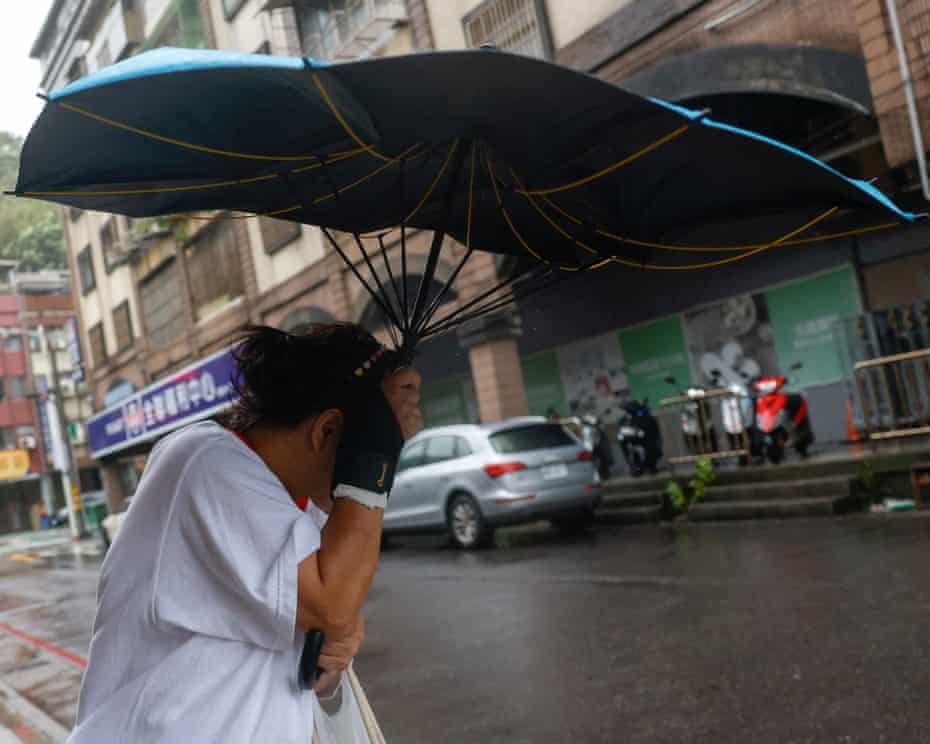
Typhoon Champi was reported to have produced sustained winds of up to 185mph, making it the strongest storm of the year so far, after battering Taiwan and Japan’s southern islands. The storm brought destructive winds, intense rainfall and widespread power outages, leaving one person dead and 527 injured, according to the supplied report.
Champi approached Taiwan’s eastern coast before changing direction near Yilan County, moving south along the coastline, looping offshore and then tracking northwards away from the island. Parts of Yilan recorded more than 620mm of rain over 48 hours, while wind gusts reached 141mph.
By Monday, the system had weakened to a tropical storm as it moved southwest of Japan’s mainland. Meanwhile, separate weather threats were developing elsewhere, with Greece facing renewed flood risks and India monitoring a cyclonic system over the west-central Bay of Bengal.
Typhoon Champi: Death Toll, Injuries and Power Outages
The reported death toll from Champi stood at one, while 527 people had been injured. The storm also disrupted electricity supplies across affected areas. More than 288,000 homes were without power at one point, although most had been reconnected by the time of the report.
The combination of extreme winds and intense rainfall created significant hazards across Taiwan’s eastern areas and Japan’s southern islands. Heavy precipitation can overwhelm drainage systems, trigger flash flooding and destabilise slopes, while powerful gusts can damage buildings, bring down trees and disrupt electricity networks.
The rainfall recorded in Yilan was particularly notable: more than 620mm over 48 hours. Such totals can produce dangerous conditions even after the strongest winds have passed, because floodwater and saturated ground may continue to pose risks as a storm moves away.
Although Champi had weakened considerably by Monday, the change in classification did not automatically mean all weather-related dangers had ended. Local authorities and residents in affected areas would still need to follow official updates concerning flooding, damaged infrastructure and recovery work.
How Typhoon Champi Tracked Near Taiwan
Champi’s path took it close to Taiwan’s east coast before the centre turned south along the Yilan County coastline. It then looped offshore and moved northwards away from the island.
The reported peak sustained winds of 185mph and gusts of up to 141mph describe different measures of wind intensity. Sustained winds refer to winds averaged over a defined period, while gusts capture shorter bursts of stronger wind. The averaging period can vary by meteorological agency, so the figures should be interpreted in the context of the original reporting.
After affecting Taiwan and Japan’s southern islands, the storm weakened rapidly as it moved southwest of Japan’s mainland. Its downgrade to a tropical storm marked a reduction in intensity, but the overall impact included injuries, a fatality, electricity disruption and exceptionally heavy rainfall.
Greece Issues Flood Alerts as More Heavy Rain Forecast
While Champi weakened in the western Pacific, Greece faced another period of unsettled weather. The supplied report said parts of the country were at risk of flooding for the fourth time in October, as low-pressure systems were expected to bring thunderstorms and prolonged heavy rain.
The national meteorological agency issued warnings for Monday, forecasting 30mm to 60mm of rain over 12 hours across central areas. The north-eastern Aegean Islands were forecast to receive between 50mm and 80mm during the same period.
Forecast models also indicated the possibility of comparable rainfall totals between Wednesday and Thursday. If these amounts materialise, further flooding could occur, particularly in places where previous rainfall has already left the ground saturated or drainage systems under pressure.
The forecast pointed to a developing sequence of weather systems, with an initial period of thunderstorms and heavy rain followed by a deeper low-pressure area moving across southern parts of Greece. The precise effects would depend on the systems’ paths, rainfall intensity and local conditions.
Heavy rain does not lead to the same level of flooding everywhere. Local topography, river levels, drainage capacity and the duration of rainfall can all influence the outcome. Residents in areas covered by official warnings should monitor updated forecasts and follow instructions from local emergency services.
Cyclone Arnab Raises Heavy Rain Concerns Along India’s East Coast
India was also monitoring a separate weather system that developed into a cyclonic storm over the west-central Bay of Bengal during the weekend. According to the supplied report, Cyclone Arnab was expected to move towards the north Andhra Pradesh–south Odisha coast by Wednesday.
The India Meteorological Department had alerts in place for extremely heavy rainfall, thunderstorms and strong surface winds across eastern parts of the country. Forecast models indicated that wind gusts could reach 85mph as the system approached land, with six-hour rainfall totals potentially reaching 100mm.
The expected landfall timing and projected track remained important factors in determining which areas could experience the most severe conditions. The system was forecast to move further north after making landfall before gradually weakening over north-eastern India towards the end of the week.
What the Forecast Could Mean for Coastal Areas
Heavy rainfall and strong winds associated with a coastal storm can disrupt transport, damage vulnerable structures, interrupt electricity supplies and create dangerous conditions for people living in exposed areas. Intense rain over a short period can also cause waterlogging and flash flooding, particularly in low-lying locations.
Coastal communities in the projected path should follow updates from the India Meteorological Department and local authorities. Any evacuation advice, restrictions on marine activity or other emergency instructions should take precedence over general forecasts.
Forecasts can change as a weather system develops. The expected landfall location, intensity and rainfall distribution may be revised as new observations become available, making regular official updates particularly important in the days before the system reaches the coast.
Three Weather Threats Highlight the Importance of Early Warnings
Champi’s impact in Taiwan and Japan, flood warnings in Greece and the developing cyclonic system near India illustrate how different weather hazards can emerge across several regions at the same time. The systems are separate and have different atmospheric conditions, but each presents risks associated with extreme winds, heavy rainfall or flooding.
In Taiwan, the reported impacts included one death, 527 injuries and extensive power disruption, alongside more than 620mm of rainfall in parts of Yilan over 48 hours. Greece faced forecasts of heavy rain capable of triggering further flooding, while India prepared for the possibility of intense precipitation and strong winds along its eastern coast.
Early warnings can help communities prepare, but their effectiveness also depends on people receiving, understanding and acting on official advice. Practical precautions include securing loose outdoor objects, avoiding flooded roads, keeping away from downed power lines and preparing essential supplies where severe weather is expected.
People should not assume that a storm is harmless simply because its classification has been downgraded or its centre has moved away. Flooding, damaged infrastructure and hazardous local conditions can persist after the most intense phase of a storm has passed.
What Happens Next?
Champi had weakened to a tropical storm by Monday, according to the supplied report, following its passage near Taiwan and Japan’s southern islands. The immediate concerns in affected areas included the consequences of the storm’s extreme rainfall, injuries, electricity outages and any remaining local hazards.
In Greece, attention was focused on the expected sequence of heavy rain and thunderstorms, including forecast totals of up to 80mm over 12 hours in parts of the north-eastern Aegean Islands. In India, the projected movement of Cyclone Arnab towards the north Andhra Pradesh–south Odisha coast made the next several days important for monitoring rainfall and wind forecasts.
These forecasts remain subject to change. Residents and travellers in potentially affected areas should check the latest information from their national meteorological agencies and local emergency authorities before making decisions about travel or outdoor activities.
Note: The storm names, intensity figures, casualty numbers and forecast dates in this report are based on the supplied source material and have not been independently verified here. Readers should consult official meteorological updates for the latest conditions and warnings.
For breaking news and live news updates, like us on Facebook or follow us on Twitter and Instagram. Read more on Latest World on thefoxdaily.com.





COMMENTS 0