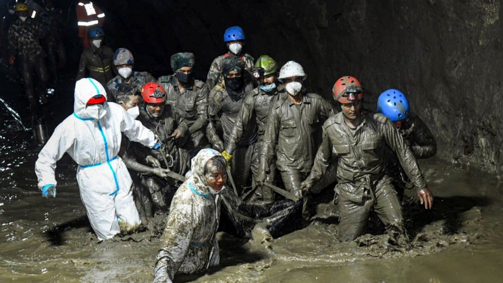
A massive section of the Langtang Lirung mountain in Nepal broke away before crashing into a Himalayan valley, sending an enormous mixture of rock, ice and debris downstream and helping trigger the devastating floods that followed.
A new assessment by the World Weather Attribution (WWA) estimates that about 110 million cubic metres of rock and ice came down from the mountain. The avalanche tore away an estimated 2.2 square kilometres of the mountain’s northern face, with the affected section reaching a depth of about 50 metres.
The scale of the collapse is difficult to comprehend. The affected area was roughly equivalent to 300 Football fields, with rock and ice filling the space to a depth comparable to a multi-storey building.
According to the study, the material fell about 1,400 metres from an elevation of roughly 5,150 metres before striking the valley floor. The impact generated a seismic shock measured at approximately 5.2 magnitude.
The findings suggest that the disaster was not simply the result of one extreme weather event. Instead, scientists describe it as a compound crisis in which geological instability and climatic changes interacted, with Climate Change acting as an important destabilising factor.
How the Langtang Lirung avalanche triggered the flood
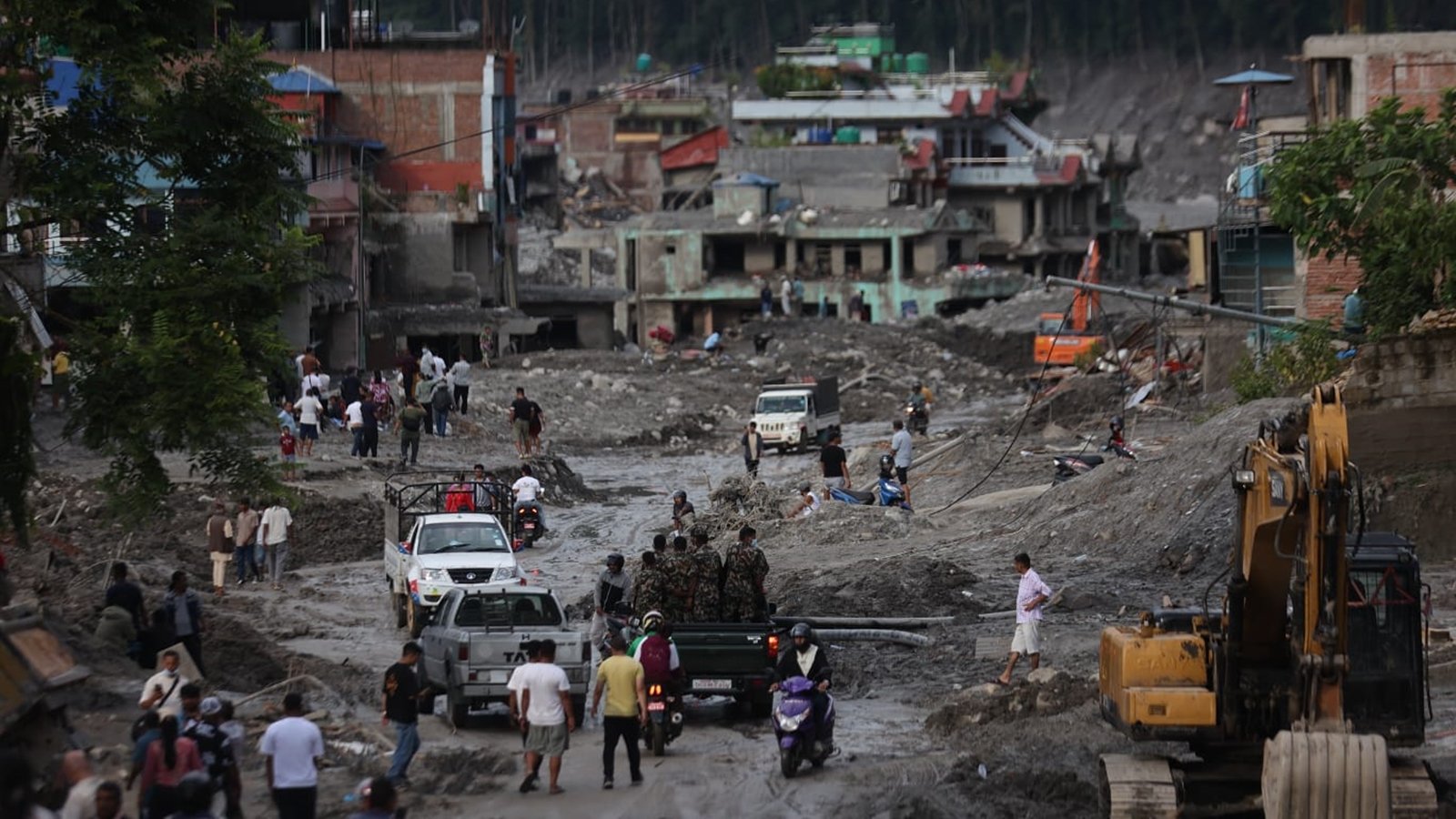
The sequence began high in the Himalaya, where a large section of unstable mountain rock and ice gave way.
The enormous mass plunged down the mountainside and hit the valley below with tremendous force. Rather than remaining a relatively contained landslide, the avalanche eroded and collected additional material as it travelled.
That included buried glacier ice from the valley floor. As more rock, ice, sediment and other debris became incorporated into the moving mass, the volume of material increased significantly.
The result was a rapidly moving debris flood capable of travelling far beyond the original point of the mountain collapse.
The WWA assessment found that the debris reached Gyirong Port in Tibet only seven to eight minutes after reaching the valley bottom. The estimated average speed was around 170 kilometres per hour.
Such speeds leave very little time for people downstream to react. In mountainous terrain, where valleys can channel enormous quantities of water and debris into narrow corridors, a sudden avalanche can therefore transform into a wider flood disaster.
Why scientists describe it as a compound crisis
The study’s central finding is that there was no single explanation for the mountain failure.
Researchers examined climate models, observed temperatures, local temperature Trends, glacier thinning, precipitation patterns and other evidence to understand the conditions that may have contributed to the collapse.
The factors identified in the assessment include:
- Glacier thinning: Long-term ice loss has changed the structure and stability of the high-altitude environment.
- Permafrost thaw: Frozen rock and soil are warming and thawing, potentially weakening mountain slopes.
- Higher temperatures: Increasing temperatures can accelerate glacier melt and affect frozen ground at high elevations.
- Increased meltwater: Additional water can enter cracks and fractures within mountain rock.
- Changing precipitation: Warmer conditions can mean more precipitation falls as rain rather than snow at high elevations.
- The 2015 earthquake: The magnitude 7.8 earthquake may have weakened or pre-conditioned the slope, although its exact contribution could not be confirmed.
These factors did not necessarily operate independently. Their combination may have progressively weakened the mountain environment until a large section of the slope eventually failed.
Climate change was a destabilising factor, not the sole cause
The scientists behind the assessment made an important distinction when describing the role of climate change.
The study does not say that climate change directly caused the mountain to collapse. Instead, it describes climate change as a destabilising factor acting on an existing geological weakness.
This distinction matters because Himalayan mountain failures are influenced by the physical structure of individual slopes, fractures in bedrock, previous earthquakes, Glaciers, water movement and other local conditions.
Friederike Otto, Professor of Climate Science at Imperial College London, said during a briefing on the analysis that human-induced climate change played a role in the disaster’s pre-conditioning through factors including permafrost thaw, glacier thinning and changes in precipitation from snow towards rainfall.
The researchers therefore view the event as an interaction between a changing climate and a mountain system that already had geological vulnerabilities.
Permafrost thaw is changing high Himalayan slopes
One of the most important elements in the study is the role of permafrost.
Permafrost refers to ground that remains frozen for extended periods. In high mountain regions, frozen conditions can exist inside rock and soil, helping influence the physical stability of steep slopes.
As temperatures rise, ice within fractures can thaw. This can alter the forces holding sections of rock together and potentially weaken the structural integrity of mountain walls.
The WWA assessment said warming and permafrost degradation likely weakened the source rock wall by increasing bedrock temperatures and thawing ice within fractures.
Professor Walter Immerzeel, a Mountain Hydrologist at Utrecht University, explained that climate change is pushing the freezing line, or zero-degree isotherm, upward by roughly 100 metres per decade. This exposes higher areas of permanently frozen ground and bedrock to longer periods of thawing.
The effect becomes particularly significant when permafrost degradation occurs alongside glacier retreat and unusually high summer temperatures. Mountain slopes that remained stable under colder conditions can face a different set of physical stresses as temperatures rise.
The 2015 earthquake may have weakened the slope
Nepal’s devastating 7.8 magnitude earthquake in 2015 is another part of the disaster’s geological background.
The earthquake caused extensive damage across Nepal and affected mountain landscapes throughout the region. Powerful seismic activity can fracture rock and alter the stability of steep slopes.
However, the WWA assessment did not establish exactly how much the earthquake contributed to the Langtang Lirung collapse.
Instead, the study suggested that the earthquake may have “pre-conditioned” the slope for failure. In other words, it may have created or intensified weaknesses that remained in the mountain for years before the eventual collapse.
This uncertainty is important. It means the disaster cannot be attributed to the 2015 earthquake alone, just as it cannot be explained solely by recent warming or a single rainfall event.
Glacier retreat has accelerated
The condition of the Langtang Lirung glacier provides another indication of how the high-altitude environment has been changing.
According to the assessment, glaciers in the region have been losing mass for decades at an average rate of around half a metre per year.
The retreat of the Langtang Lirung glacier has also accelerated since 2010. The study estimates that the glacier’s rate of recession increased from approximately 0.5% per year over the preceding two centuries to between 1% and 2.3% per year during the past 16 years.
Glacier loss matters not only because it reduces the amount of ice stored in the mountains. It can also change the physical conditions around steep slopes and alter the way meltwater moves through high-altitude terrain.
When combined with warming permafrost, increased meltwater and changing precipitation, long-term glacier retreat can become part of a much larger chain of environmental changes.
The avalanche itself was an extremely rare event
Rock avalanches on the scale described in the assessment are exceptionally uncommon.
The study estimates that events of this magnitude may occur only once every 1,000 to 10,000 years. That rarity makes the Langtang Lirung collapse especially significant for scientists studying future Himalayan hazards.
However, the rarity of the event does not mean that similar risks can be ignored. Mountain environments are changing, and individual slopes can respond differently to warming, glacier retreat, earthquakes and water infiltration.
The challenge for scientists and authorities is therefore not simply to predict the next avalanche but to identify slopes and valleys where multiple risk factors could combine.
Why the Himalaya faces growing disaster risks
The Himalaya contains some of the world’s highest mountains, extensive glaciers and large areas of steep and unstable terrain. Communities, roads, Trade routes, tourism sites and river systems exist downstream from these high-altitude environments.
A collapse occurring several thousand metres above a valley can therefore create consequences far from the original site of failure.
The Langtang Lirung event demonstrates how a mountain hazard can evolve rapidly. A rock and ice avalanche can pick up additional material, interact with water and ice, and transform into a debris flow or flood capable of moving through downstream valleys at high speed.
This makes monitoring particularly difficult. A warning system designed only to detect rainfall may not be sufficient when the initial trigger is a mountain collapse caused by several interacting factors.
Scientists call for stronger Himalayan monitoring
The WWA assessment calls for stronger earth observation, hazard monitoring and cross-border data sharing across the high Himalaya.
These measures could improve understanding of changes in glaciers, mountain slopes, permafrost and river systems before a major failure occurs.
Satellite observations can help track glacier retreat and changes in mountain surfaces, while ground-based monitoring can provide additional information about slope movement and environmental conditions. Combining these sources can help researchers identify changes that might otherwise remain difficult to detect.
Trans-boundary cooperation is particularly important because Himalayan rivers and hazards do not stop at national borders. A collapse or flood originating in one part of the mountain system can rapidly affect communities and infrastructure downstream in another country.
Sharing observations, warnings and scientific data can therefore become an important part of disaster preparedness.
Past warming may continue to affect the mountains
The assessment also highlights a longer-term concern: some consequences of previous warming may not have fully emerged yet.
Even if future warming were to slow, glaciers and permafrost can continue responding to changes that have already taken place. The physical systems of high mountains do not necessarily adjust immediately to atmospheric temperature changes.
This creates a continuing hazard-management challenge for Himalayan countries. Monitoring cannot focus only on current temperatures or today’s weather. Long-term changes in glaciers, frozen ground and mountain structure also need to be considered.
The study therefore links disaster risk reduction with both adaptation and broader climate policy. It calls for reducing fossil fuel use while also delivering climate finance needed to help vulnerable regions adapt to changing conditions.
A warning about the changing Himalayan risk landscape
The Langtang Lirung disaster illustrates how extreme mountain events can emerge from a combination of geological and climatic pressures.
An estimated 110 million cubic metres of rock and ice collapsed from a mountain face covering about 2.2 square kilometres. The material plunged roughly 1,400 metres, generated a seismic shock and then gathered additional debris as it raced through the valley.
The resulting flood was therefore not simply a conventional rainfall-driven event. It was the downstream consequence of a complex chain involving mountain instability, ice, rock, water, glacier change and environmental warming.
For scientists, the event provides a rare opportunity to study how these processes interact. For communities across the Himalaya, it underlines the importance of early warning systems, high-altitude monitoring and stronger cooperation across borders.
The study’s central message is not that climate change alone caused the mountain to collapse. Rather, warming appears to have increased vulnerabilities in an already complex geological environment. As glaciers continue to retreat and high-altitude permafrost continues to degrade, understanding those interactions will be increasingly important for assessing future flood and landslide risks across the Himalaya.
For breaking news and live news updates, like us on Facebook or follow us on Twitter and Instagram. Read more on Latest World on thefoxdaily.com.




COMMENTS 0