Three months before a catastrophic glacier collapse triggered a torrent of water, mud and rock along the Nepal–China border, officials from Nepal and China were already discussing how to improve cooperation on Himalayan disaster risks.
At a May 27 meeting in Kathmandu, Nepalese officials sought stronger information-sharing on glaciers, river conditions, floods, Weather and other extreme events. They called for measures including glacial-lake inventories and hazard mapping, reflecting concerns about hazards that can develop far upstream before they reach communities in Nepal.
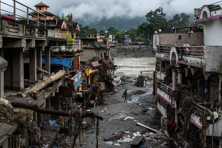
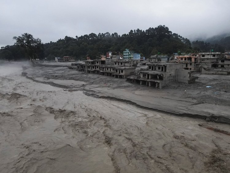
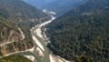
On August 26, that concern became a devastating reality. A rapid glacier-related slope failure near the Nepal-China border sent an enormous debris flow into mountain river systems, destroying Infrastructure and sweeping through settlements in Nepal and the Tibet region of China.
The disaster has since exposed a difficult gap between identifying Himalayan risks and creating a cross-border warning system capable of responding to them quickly. Nepalese officials say they wanted more information on glacier movements, water levels, avalanches and landslides. China says it shared important information in a timely manner and that the two countries had made substantial progress on disaster information-sharing.
The dispute is therefore not simply about whether a warning existed. It is about what information was available, how frequently it was shared, how quickly it could travel across the border and whether that information could have provided enough time for communities to act.
Nepal had raised the need for better glacier warnings before the disaster
The May meeting is significant because it shows that the need for better cross-border disaster monitoring had been identified before the August catastrophe.
According to an agenda prepared by Nepal and reviewed by Reuters, 10 Nepalese officials and about a dozen Chinese officials, including representatives from Tibet, discussed cooperation on floods, weather and glacier-related hazards.
The participants discussed joint risk-reduction measures such as inventories of glacial lakes and hazard mapping. These are important tools in a region where a change in a high-altitude glacier, unstable slope or glacial lake can eventually affect communities much farther downstream.
Nepal’s request was also more specific than simply asking for weather forecasts.
Sauhardra Joshi, a hydrologist with Nepal’s Flood Forecasting Division who participated in the meeting, said Nepal wanted to know earlier about movements around glaciers and other early signs of danger.
That distinction matters. A forecast for heavy rain can provide useful advance notice of rainfall-driven floods, but it does not necessarily reveal that a glacier or unstable mountain slope is about to collapse.
For Nepal, which sits downstream of numerous high-altitude valleys and shares river systems with the Tibetan region, information generated upstream can be crucial to the country’s ability to issue warnings downstream.
China says it did share information in a timely manner
Beijing has rejected the suggestion that China simply withheld information from Nepal.
The Chinese embassy in Nepal said the two countries had maintained close communication and made substantial progress at the May meeting on cross-border disaster information-sharing. China also emphasized the difficulties involved in monitoring hazards in a remote Himalayan border Environment.
The Chinese position is important because the available evidence does not establish that a missing warning directly caused the August disaster. Officials and experts have cautioned against drawing that conclusion.
Nepalese officials themselves have acknowledged receiving weather information from China. Binod Parajuli, a Nepal government hydrologist, said China provided forecasts and observations when heavy precipitation was expected over Tibet.
But Nepal wanted broader information, including data relating to avalanches, water levels, landslides and other extreme events.
That difference in expectations helps explain the current push by Kathmandu for a more formal and comprehensive data-sharing arrangement.
China had warned Nepal about heavy rain before the flood
There was an advance weather warning before the August 26 disaster.
Twelve days before the catastrophe, China’s World Meteorological Centre warned Nepalese officials by email about enhanced rainfall and possible secondary and cascading hazards, including landslides and flash floods.
That warning demonstrates that some cross-border weather communication was already functioning.
But the disaster that followed was not a straightforward rainfall event. Scientific and geological assessments indicate that a rapid slope failure involving a glacier generated an ice-and-rock avalanche and debris flow that entered the river system.
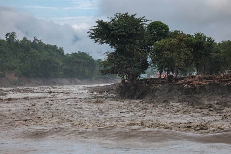
The United States Geological Survey said the August 26 event was likely triggered by rapid slope failure involving a glacier near the border with China. Its preliminary assessment described a debris flow and flood that travelled downstream along the Lende Khola and Trishuli Khola river systems.
That distinction between weather forecasting and hazard monitoring is central to understanding why Nepal is seeking more detailed information.
Rainfall forecasts can identify one source of flood risk. They cannot by themselves provide continuous information about the stability of glaciers, rock slopes or temporary natural dams forming in remote valleys.
Why Nepal wants information as frequently as every 10 minutes
Nepal’s proposed approach is to move from occasional or event-based warnings toward much more frequent upstream monitoring.
Parajuli said Nepal wants glacier-related information at intervals of roughly 10 minutes rather than relying primarily on heavy-rainfall forecasts.
The objective is not necessarily to predict every glacier collapse with perfect precision. Instead, frequent observations could help authorities identify unusual changes and react faster when a dangerous event begins.
A modern Himalayan early-warning system could combine several forms of information:
- Upstream river-level measurements
- Glacier and snow observations
- Satellite imagery
- Rainfall and weather forecasts
- Landslide and avalanche monitoring
- Automated alerts from high-risk locations
- Rapid communication between agencies on both sides of the border
The advantage of combining these systems is redundancy. If one sensor stops working or is destroyed, another source may still provide information.
That became especially important during the August disaster because monitoring stations themselves were overwhelmed.
The August 26 flood moved with extraordinary speed
The timeline of the disaster shows how little time authorities can have once a major Himalayan slope failure occurs.
At about 8:32 a.m. Nepal time on August 26, a huge surge of water, mud and debris struck the Gyirong border area in Tibet. The event quickly propagated into river systems flowing toward Nepal.
Within minutes, Nepalese officials began receiving reports of flooding.
Parajuli said he received a call about flooding on the Trishuli River roughly 26 minutes after the initial event. Around 8:40 a.m., a border monitoring station stopped transmitting data.
Attempts to contact downstream stations also encountered problems. Officials suspected that some monitoring equipment had been washed away.
After confirming the flooding with local authorities, Nepal’s team issued a public alert to mobile-phone users at approximately 9:13 a.m.
The sequence illustrates a fundamental problem with disaster warning in mountainous terrain: a system may be capable of detecting a flood but still struggle to maintain communications during the most dangerous part of the event.
The flood destroyed the infrastructure designed to monitor it
At least four monitoring stations were destroyed as the flood travelled downstream, according to the information provided by Nepalese officials.
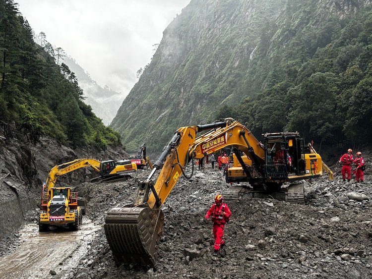
The disaster also destroyed or damaged vital transport infrastructure. Reuters reported that at least 19 bridges and about 40 kilometres of highway were damaged, while the Stimson Center estimated that more than 10% of Nepal’s power-generation capacity was knocked out.
USGS analysis indicates that the debris flow travelled through the Lende Khola and Trishuli Khola river systems, affecting populated areas and infrastructure downstream.
This creates an important lesson for future warning systems: monitoring equipment must be able to survive, or be replaced by alternative sources of information, when an extreme event occurs.
In other words, early warning cannot depend on one river gauge sitting directly in the path of a flood. Satellite monitoring, upstream sensors and independent communication channels can provide critical backup when ground infrastructure disappears.
What caused the August disaster?
The current scientific picture points to a glacier-related slope failure rather than a conventional rainstorm flood.
Satellite imagery examined by scientists showed that a section of glacier broke away at high altitude before plunging toward the valley below. The resulting ice-and-rock avalanche gathered additional material and entered the river system, creating a destructive flood downstream.
USGS has described the event as a catastrophic debris flow and flood likely triggered by rapid slope failure involving a glacier.
Early reports also considered whether an earthquake had triggered the collapse. Subsequent analysis indicated that the seismic signal associated with the event was generated by the landslide itself rather than by an earthquake causing the collapse.
The distinction matters because it illustrates how difficult it can be to determine the cause of a rapidly unfolding Himalayan disaster in real time.
Authorities may initially have only fragmented information from sensors, satellite imagery and eyewitness reports. By the time the physical cause is established, the flood itself may already be far downstream.
Experts say better data is needed, but it may not have prevented this disaster
Environmental anthropologist Austin Lord, a senior fellow at the Stimson Center, has described the existing Nepal-China disaster information-sharing system as limited and insufficiently developed.
He has also highlighted the difference in monitoring resources between the two countries, with Chinese institutions having significantly greater capacity for monitoring than Nepalese agencies overall.
Yet experts and officials have cautioned against treating the lack of a comprehensive bilateral warning system as the main cause of the August disaster.
The collapse occurred in a relatively unmonitored area and developed rapidly. Even a more advanced warning network might not have provided a long lead time.
That is an important distinction. Better data can improve preparedness without guaranteeing that every disaster can be predicted.
The practical goal of an early-warning system is therefore not perfect prediction. It is to maximize the time between reliable detection and impact while ensuring that warnings reach people who can act on them.
Nepal wants a formal agreement similar to its arrangement with India
Nepal is now considering a formal data-sharing agreement with China based on its existing cooperation with India.
According to Parajuli, the proposed arrangement could provide more frequent information about precipitation and river levels while expanding cooperation on other hazards.
A formal framework could clarify several issues that become critical during an emergency: which agencies share data, what measurements are transmitted, how frequently they are updated, how warnings are verified and who is responsible for communicating them to communities.
The challenge will be converting political cooperation into a system that operates automatically and continuously.
For a river warning to be useful, information needs to travel faster than the flood. That requires monitoring Technology, communication infrastructure and agreed procedures to function together.
Claims about Chinese construction should be treated separately
The disaster has also prompted allegations that construction activity on the Chinese side of the border may have affected the landscape and contributed to the flooding.
Nepal Correspondence, a social-media platform operated by Nepali journalists, alleged that construction around Gyirong, including Xiaokang settlements and the Gyirong border port, had damaged the Himalayan ecosystem and influenced the movement of floodwater.
Down To Earth reported the allegations but noted that they could not be independently verified.
Those claims should therefore be separated from the established evidence concerning the immediate trigger of the disaster.
Nepalese and Chinese authorities have identified a glacier-related collapse as the cause of the flash flood, while USGS analysis has likewise pointed to rapid slope failure involving a glacier. Determining whether construction or landscape modification had any additional influence would require a separate geological and hydrological Investigation.
Attributing a disaster of this scale to unverified allegations would risk confusing political claims with scientific evidence.
The warning problem extends beyond Nepal and China
The geography of the disaster makes the issue bigger than a bilateral Nepal-China disagreement.
The affected river system runs from the high Himalayas through Nepal and eventually connects with the Narayani River, which enters India and becomes the Gandak.
That means a major upstream event can create consequences across multiple countries. Information about an emerging hazard in the mountains can become relevant to communities hundreds of kilometres away.
The August flood therefore demonstrates why Himalayan disaster preparedness increasingly needs to operate around shared river basins rather than only around national borders.
For Nepal, the immediate concern is protecting settlements, roads, hydropower projects and other infrastructure along vulnerable valleys. For China, the same information can help protect communities and border infrastructure in Tibet. For India, upstream warnings can provide additional time to prepare for downstream river-level changes.
The real test is whether early warning becomes early action
Nepal’s demand for more frequent glacier and river information is ultimately about something much simpler than technology: buying time.
A warning issued several minutes earlier can allow authorities to close a road, stop traffic from entering a dangerous valley, evacuate a settlement or alert workers inside vulnerable infrastructure.
But the warning must be reliable and actionable. Too many false alarms can reduce public confidence, while a warning that arrives after communications have already failed may be practically useless.
The most effective system would therefore connect upstream monitoring directly to emergency response procedures. Satellite observations and sensors could identify unusual conditions; hydrologists could assess the threat; automated systems could transmit alerts; and local authorities could activate evacuation plans.
The August disaster showed why every link in that chain matters.
What happens next for Nepal’s cross-border warning system
The immediate priority for Nepal is likely to be strengthening cooperation with China rather than assigning responsibility for a natural disaster that scientists say developed extremely rapidly.
The country is seeking more frequent data on glaciers, rivers and extreme events and plans to pursue a formal arrangement for information-sharing. The success of that effort will depend on whether both sides can establish practical procedures for continuous monitoring and rapid communication.
The August catastrophe does not prove that additional Chinese data would have prevented the loss of life. The available evidence is not sufficient to make that claim, and the event occurred in an area where monitoring was limited.
But the disaster does demonstrate why Nepal’s earlier request mattered.
Three months before the flood, officials were already discussing glacial lakes, hazard maps and cross-border monitoring. Weeks later, a glacier-related collapse sent a massive flood through the same broader Himalayan environment.
The lesson is not that every glacier collapse can be predicted. It is that the gap between detecting danger and warning people must be made as small as technology, geography and reliable science allow.
For Nepal and its neighbours, the next phase of Himalayan disaster preparedness will depend on turning that principle into a functioning cross-border system, one capable of delivering the right information quickly enough for communities to act before the next wall of water reaches the valley below.
For breaking news and live news updates, like us on Facebook or follow us on Twitter and Instagram. Read more on Latest World on thefoxdaily.com.





COMMENTS 0