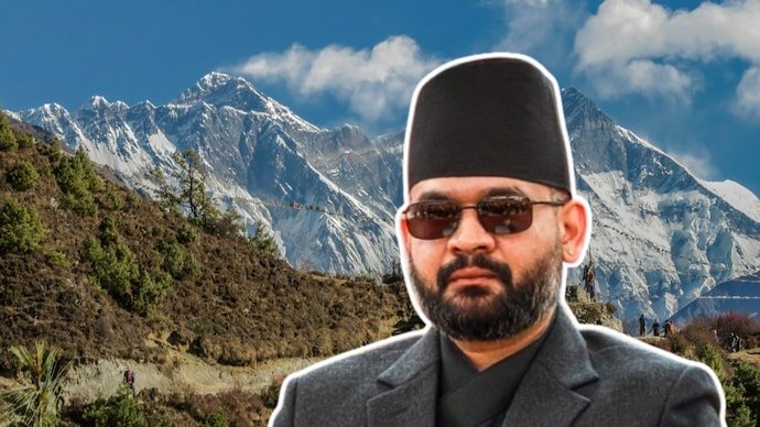
Nepal‘s long-running claim over the Lipulekh, Kalapani and Limpiyadhura areas has acquired a new historical complication: Kathmandu cannot definitively confirm that it possesses the original copy of the 1816 Sugauli Treaty, the agreement that remains central to arguments over Nepal’s western boundary.
The issue came before Nepal’s Parliament after lawmakers questioned the government about the location and authenticity of the country’s historic treaty documents. Foreign Minister Shisir Khanal acknowledged that officials could not say with certainty whether the original Sugauli Treaty document was in Nepal’s possession, although records connected with the treaty are believed to exist in the country’s archives.
The revelation does not, by itself, settle the India-Nepal Border Dispute. The existence of copies, maps, administrative records and other historical material means the territorial question cannot be reduced to whether one physical document survives. But the uncertainty is significant because the treaty’s wording is at the centre of Nepal’s argument over where the Kali, or Mahakali, River begins.
The timing is also notable. The issue has resurfaced while India and china have resumed traditional border trade through the Lipulekh Pass, a development Nepal has opposed because Kathmandu maintains that Lipulekh, Kalapani and Limpiyadhura are part of Nepal.
What Nepal says about the missing Sugauli Treaty
Speaking in Nepal’s House of Representatives, Foreign Minister Shisir Khanal said the government did not have clear information confirming whether it possessed the official original treaty document.
That uncertainty is not entirely new. Nepal has been searching for original copies of important historical treaties for years. A parliamentary inquiry previously examined government offices, libraries, archives, museums and other repositories while looking for the original Sugauli Treaty as well as the 1950 Nepal-India Treaty of Peace and Friendship.
The search became particularly relevant in 2016, when the Eminent Persons’ Group on Nepal-India relations began discussions concerning the 1950 treaty. Nepal attempted to locate its original copy but reportedly could not find it and eventually supplied the group with another copy.
In 2019, then Foreign Minister Pradeep Gyawali also acknowledged that Nepal had treaty documents but that their status as original documents required forensic verification. Officials were simultaneously looking for historical documents and maps in India and the United Kingdom.
The latest parliamentary discussion therefore represents a continuation of a longstanding archival problem rather than evidence that the Sugauli Treaty itself has disappeared from historical records.
Why the Sugauli Treaty remains central to the India-Nepal border dispute
The Treaty of Sugauli emerged from the Anglo-Nepal War of 1814-16. It was signed in December 1815 and ratified in March 1816 between the Kingdom of Nepal and the British East India Company.
The agreement became a foundational document for the territorial relationship between Nepal and British-controlled India. Its provisions dealt with territory, political relations and the boundaries separating the two sides.
For the modern dispute, one provision is especially important: Article V. It states that the King of Nepal renounced claims to territories lying west of the River Kali and agreed not to have dealings with those territories or their inhabitants.
On paper, that appears straightforward. If the Kali River is the boundary, land east of it would fall on the Nepalese side and land west of it would fall on the Indian side.
The difficulty is that the treaty did not definitively resolve the geographical question that now drives the dispute: where exactly does the Kali River originate?
The Kali River question is the heart of the dispute
Nepal’s position is that the Kali originates at Limpiyadhura. If that interpretation is accepted, the river’s course places Limpiyadhura, Kalapani and Lipulekh on the eastern side of the boundary river, supporting Nepal’s territorial claim over those areas.
India disputes that interpretation. Its position is that the Kali originates from springs in the Kalapani area farther east and that the disputed territory falls within Uttarakhand.
This disagreement is not simply a matter of drawing a modern line on a map. The two countries have relied on different historical maps, administrative records and other evidence when presenting their respective positions.
That is why the missing original treaty has attracted attention. The document is historically important, but the broader evidence surrounding the treaty is equally significant. Maps created during the British period, subsequent administrative practices, revenue records and records concerning settlements and border demarcation all form part of the historical debate.
There is also an important limitation to the treaty itself: Article V identifies the Kali as the western boundary but does not explicitly name Limpiyadhura as the river’s source. That unresolved geographical point has allowed competing interpretations to persist for generations.
Does the missing original treaty weaken Nepal’s territorial claim?
Not automatically.
The absence of Nepal’s original physical copy does not erase the treaty or invalidate the historical agreement. Treaties can be established through authenticated copies, archival records, official reproductions and records held by other parties. The original document is valuable evidence, but it is not necessarily the only evidence relevant to determining a historic boundary.
In the Nepal-India case, the dispute is fundamentally about the interpretation and implementation of a boundary arrangement. The central question is how the Kali River mentioned in the treaty should be geographically identified and how subsequent historical records should be understood.
That makes the archival search important, but it also explains why finding the original paper would not necessarily end the dispute overnight.
A physical document could clarify questions about the wording, authenticity or associated material, but it would not automatically answer every geographical question surrounding the river’s source. Those questions require examination of maps and other historical evidence.
Why maps matter almost as much as the treaty
Historical maps have played a major role in the Kalapani dispute because the treaty’s reference to the Kali River needs to be translated into a physical boundary.
Over the decades, different maps and records have depicted the region and the river system in different ways. The interpretation of those documents is therefore central to the arguments made by both Nepal and India.
For Nepal, historical material that identifies the river’s source near Limpiyadhura is important to its claim. India, meanwhile, points to its own historical and administrative records concerning the area.
This is one reason the debate cannot be reduced to a simple question of which country possesses the oldest piece of paper. International boundaries often depend on a combination of treaties, maps, subsequent demarcation and long-term administration.
The Sugauli Treaty provides the historical foundation for the western boundary, but later evidence is essential for determining how that boundary was understood and applied on the ground.
How the dispute became a major political issue in Nepal
The territorial dispute became especially prominent in Nepal’s domestic Politics in 2020.
After India inaugurated a road linking the Uttarakhand region to Lipulekh, Nepal objected, arguing that the route passed through territory it considered its own. The dispute escalated when the government led by then Prime Minister KP Sharma Oli issued a new political map incorporating Lipulekh, Kalapani and Limpiyadhura within Nepal’s borders.
Nepal’s Parliament subsequently approved a constitutional amendment associated with the revised map, giving the territorial claim a stronger domestic political and constitutional dimension.
India rejected Nepal’s revised territorial map and described the claims as an artificial enlargement of Nepal’s territory. New Delhi argued that the move was not based on historical facts and evidence.
The episode placed considerable pressure on a relationship that has traditionally been characterised by an open border, extensive social links and close economic connections.
Balen Shah’s controversial admission added another layer
The latest archival controversy comes after another unusual intervention by Nepal’s current Prime Minister Balendra “Balen” Shah.
In Parliament in May 2026, Shah said that after becoming prime minister he learned that the situation was not simply a case of India encroaching on Nepalese territory. He said Nepal had also encroached on Indian land in several places and suggested that both sides should examine the situation together.
The remark attracted attention because Nepal’s territorial claims against India have traditionally been presented as a sovereignty issue. Shah’s statement appeared to acknowledge that some areas along the broader border could involve cross-border occupation or discrepancies between the fixed boundary and actual land use.
Nepal’s Foreign Ministry subsequently clarified that the prime minister’s comments referred to technical issues involving cross-border occupation and land use along the Nepal-India boundary. The ministry said that, in some places, land being used by people on one side may technically fall across the fixed boundary.
Importantly, that clarification did not amount to Nepal abandoning its position on Lipulekh, Kalapani or Limpiyadhura.
Why Lipulekh has become important again in 2026
The border dispute has returned to the diplomatic spotlight following the resumption of India-China trade through the Lipulekh Pass.
Traditional border trade between India and China through Lipulekh resumed in 2026 after a prolonged suspension. Nepal objected because it maintains that Lipulekh is part of its territory and has argued that arrangements involving the pass should not proceed without addressing its territorial claim.
India has rejected Nepal’s objections, maintaining that its claims over the disputed areas are not supported by historical facts and evidence while indicating that New Delhi remains open to constructive engagement with Kathmandu.
The reopening of the route gives the centuries-old boundary dispute a contemporary economic and strategic dimension. Lipulekh is not merely a line on a historical map. It is a mountain pass connected to trade, pilgrimage and regional connectivity.
That means developments around the pass can affect India-Nepal relations even when neither country takes a formal step toward changing its territorial position.
What the missing document actually changes
The biggest consequence of Nepal’s inability to confirm the location of the original Sugauli Treaty is not that its territorial claim suddenly disappears. Instead, it highlights the importance of establishing a complete and mutually credible historical record.
A definitive archival record could help researchers and officials compare the treaty with contemporary maps and later boundary documents. It could also clarify which versions of the treaty are held in Nepal and whether they correspond exactly to authenticated historical records.
But the dispute would still involve the interpretation of geographical evidence, particularly the source and course of the Kali River.
That distinction is crucial. The Sugauli Treaty is a historical starting point, not necessarily the complete answer to a border dispute that has evolved over more than two centuries.
What happens next in the Nepal-India border dispute?
The immediate challenge for Kathmandu is archival: determine what treaty documents it possesses, establish their provenance and compare them with records held elsewhere.
The wider diplomatic challenge is more difficult. Nepal and India must reconcile competing interpretations of historical evidence while avoiding steps that make compromise politically harder.
The most significant future discussions are likely to centre on documentary evidence, maps, boundary demarcation and the geographical interpretation of the Kali River.
For Nepal, finding the original Sugauli Treaty would strengthen its historical record if the document could be authenticated and interpreted in the context of other evidence. For India, the existence or absence of Nepal’s original copy does not remove the need to address the underlying historical and geographical arguments.
Ultimately, the missing paper is only one part of a much larger puzzle.
The Sugauli Treaty is more than 210 years old, but its language continues to shape a modern territorial dispute involving two sovereign neighbours. The fact that Nepal cannot currently confirm where its original copy is adds an extraordinary archival twist to the story, yet it does not by itself determine WHO owns Lipulekh, Kalapani or Limpiyadhura.
The decisive issue remains the evidence surrounding the boundary established after the Anglo-Nepal War, particularly the identification of the Kali River and the way that boundary was subsequently mapped and administered.
As India-China activity at Lipulekh brings the disputed region back into focus, the search for historical documents may continue. But any lasting resolution will require more than finding a 210-year-old treaty. It will require the two countries to agree on how the treaty, maps and subsequent evidence should be interpreted together.
For breaking news and live news updates, like us on Facebook or follow us on Twitter and Instagram. Read more on Latest World on thefoxdaily.com.






COMMENTS 0