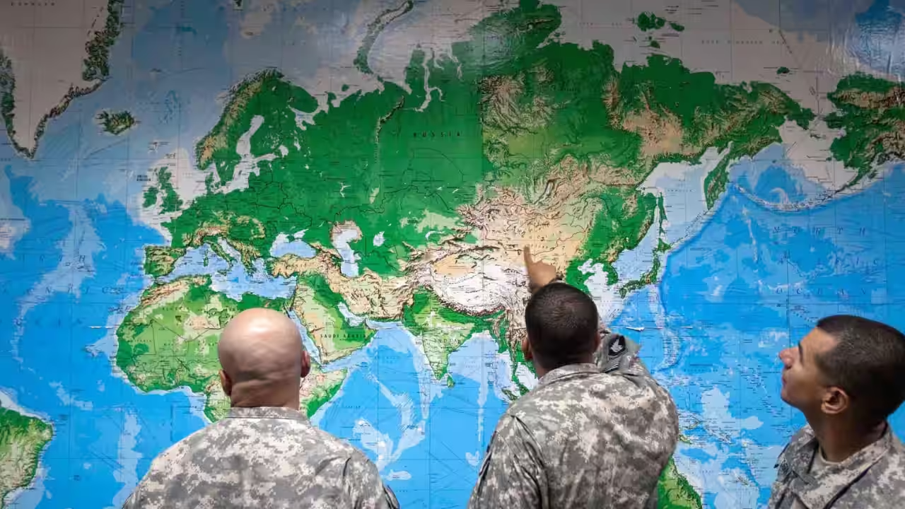
India has backed a landmark United Nations resolution on reforming world map representation, supporting efforts to reduce the distortions created by commonly used map projections while stressing that the vote should not be interpreted as an endorsement of one specific alternative.
The UN General Assembly adopted the “Correct the Map” resolution on Friday with 164 countries voting in favour, six abstaining and the United States voting against. The initiative, sponsored by Togo and supported by African countries, calls for wider consideration of map projections that more accurately represent the relative size of continents and regions.
India supported the broad objective but took care to define what its vote meant.
Speaking in the General Assembly, Raghoo Puri, First Secretary at India’s Permanent Mission to the United Nations, said New Delhi welcomed the intention to promote more accurate and representative cartographic practices. However, he clarified that India did not view the resolution as an endorsement of the Equal Earth projection or any other individual map design.
The distinction is important because the resolution has attracted considerable attention for its criticism of the familiar Mercator projection and its encouragement of equal-area alternatives.
India’s position effectively separates the principle from the specific technical solution: maps should provide a fairer representation of the relative size of the world’s landmasses, but governments and institutions should not be understood as being required to adopt one particular projection.
What is the UN “Correct the Map” resolution?
The resolution is formally titled “Correct the map”: rebalancing global cartographic representation and promoting equitable representation of the world’s regions, particularly Africa.
It focuses on how maps influence perceptions of geography and argues that widely used world maps can distort the apparent size of continents and countries.
The problem becomes especially pronounced as locations move farther north or south of the equator. Some projections enlarge land areas near the poles, meaning regions such as Europe and North America can appear substantially larger relative to countries and continents near the equator.
Africa is one of the most frequently cited examples.
The continent has a much larger actual land area than its appearance on many familiar world maps suggests. The resolution argues that continued use of distorted representations can contribute to what it describes as a form of symbolic minimisation of Africa and other regions.
The initiative therefore seeks to encourage cartographic practices that provide a more proportionally accurate visual understanding of the world.
Why is the Mercator projection being criticised?
The Mercator projection was developed by Flemish cartographer Gerardus Mercator in the 16th century. It was designed primarily for navigation because it preserves certain directional relationships that are useful when plotting routes at sea.
That purpose explains why the projection became influential and why it remains familiar today.
But it comes with a major geographical limitation: areas become increasingly enlarged as they move toward the poles.
As a result, Greenland can appear visually comparable to Africa on a standard Mercator map even though Africa’s actual land area is roughly 14 times larger.
Similar distortions affect other high-latitude regions.
The projection was not designed to provide a proportionally accurate comparison of landmass sizes. Its continued use for educational, media, digital and general-purpose maps has nevertheless meant that generations of people have grown accustomed to its visual representation.
The UN resolution does not suggest that Mercator is useless. Its original navigational purpose remains an important reason for its continued relevance.
The debate instead concerns whether it should remain the default way of showing the world when the objective is to communicate the relative size of continents and regions.
India supports fair representation, not one specific map
India’s explanation of its vote is perhaps the most important part of its position.
Raghoo Puri said India welcomed the intention behind the resolution because maps play an important role in shaping how societies understand geography and the relative scale of the world.
But he made clear that New Delhi believed the resolution should be interpreted as supporting the broader use and consideration of equal-area map projections, rather than endorsing Equal Earth or another specific projection.
This distinction matters because map projections are technical tools designed for different purposes.
No single projection can preserve every geographical property simultaneously. Some prioritise area, others shape, distance, direction or particular visual characteristics.
An equal-area projection aims to preserve the proportional relationship between land areas. That can make it more suitable when the principal goal is comparing the size of continents or countries.
But preserving area can come at the expense of other properties such as shape or distance.
India’s position therefore leaves room for different mapping systems to be used depending on their intended purpose.
What is the Equal Earth projection?
Equal Earth is an equal-area world map projection introduced in 2018 by cartographers Bojan Šavrič, Tom Patterson and Bernhard Jenny.
Its central goal is to show the world’s landmasses in their correct relative areas while producing a visually balanced world map.
Unlike the Mercator projection, Equal Earth does not dramatically enlarge areas near the poles. Africa therefore appears much closer to its true proportion relative to Europe, North America and other continents.
The projection has attracted support among organisations seeking a more geographically representative view of the world.
But India’s UN statement deliberately stopped short of saying Equal Earth should replace all other projections.
That approach reflects the technical reality of cartography. A projection suitable for displaying continental area may not be the best choice for navigation, weather mapping or specialised geographic analysis.
Why Africa is at the centre of the debate
The campaign behind the UN resolution has a strong African focus.
Africa’s actual size is frequently underestimated when people view it on traditional classroom and digital maps based on projections that enlarge northern and southern regions.
The continent covers approximately 30.37 million square kilometres, making it far larger than its familiar appearance on many world maps suggests.
For example, Africa is substantially larger than Europe and can accommodate the United States, china, India and several other major countries within its land area.
That physical reality is difficult to appreciate on a conventional Mercator map.
Supporters of the “Correct the Map” initiative argue that cartographic distortion can influence not only geography Education but also the way people understand global importance and relative scale.
They therefore see map reform as more than a technical issue.
It is also being presented as a question of how different parts of the world are visually represented in classrooms, media, official documents and digital platforms.
Does the resolution ban the Mercator map?
No.
The UN resolution does not ban the Mercator projection or require every government, school, company or online mapping service to abandon it.
The resolution encourages greater use and consideration of projections that more accurately reflect the relative size of regions, particularly Africa and other areas affected by distortions.
This distinction is important because Mercator remains useful for certain specialised purposes, especially navigation.
Its main weakness occurs when it is used to communicate a simple visual comparison of global land areas.
The UN initiative therefore seeks broader awareness of the limitations of different projections rather than imposing a universal replacement.
Why maps can never show the Earth perfectly
There is a fundamental reason why the debate over world maps will never have a single technical answer.
The Earth is approximately spherical, while a conventional map is flat.
Turning a three-dimensional globe into a two-dimensional surface necessarily creates some form of distortion.
Cartographers therefore choose projections based on what they want the map to preserve.
A projection might prioritise area, meaning countries remain correctly proportional in size. Another might preserve angles and directions, which can be valuable for navigation. Others may attempt to balance several competing properties to produce a visually useful general-purpose map.
There is consequently no universally “perfect” world map.
The significance of the UN debate lies in matching the projection to the purpose.
If the purpose is to understand the relative size of continents, an equal-area projection can provide a more useful representation than Mercator.
If the purpose is plotting maritime navigation, the requirements can be different.
India’s clarification is consistent with that broader principle.
Why India did not endorse Equal Earth specifically
India’s decision to distinguish the resolution’s objective from Equal Earth’s specific design appears to reflect the technical and policy flexibility involved in cartography.
Supporting a resolution encouraging accurate area representation does not necessarily require the country to endorse one particular projection for every use.
Different public institutions may have different mapping needs. Educational materials, statistical visualisations, navigation systems and geographic-information applications can require different projection characteristics.
India’s wording therefore leaves the door open to considering multiple equal-area or other suitable projections depending on the application.
That allows New Delhi to support the principle of accurate representation without becoming committed to a single technical standard.
Why 164 countries voted for the resolution
The overwhelming vote shows that the underlying principle attracted broad international support.
A total of 164 countries voted in favour, six abstained and the United States was the only country to vote against the resolution.
Estonia, Georgia, Lithuania, Moldova, Serbia and Ukraine were among those that abstained.
The scale of the vote reflects the appeal of the argument that geographic information should, where appropriate, represent the actual relative size of the world’s regions.
It also reflects the political importance of the resolution to African states seeking greater recognition of the continent’s role and scale.
However, the vote should not be interpreted as a decision by 164 governments to immediately replace every world map in use.
As a General Assembly resolution, the measure encourages changes in cartographic practice rather than automatically imposing a legally binding global map standard.
Why the United States voted against it
The United States was the sole country to vote against the resolution.
Washington objected to the initiative’s broader framing and criticised the political language surrounding what it sees as an effort to change cartographic representation.
The US position reflects a different assessment of the value and purpose of the UN resolution. American officials have argued that the organisation should prioritise more immediate international challenges rather than encouraging particular approaches to world maps.
That disagreement did not prevent the resolution from passing overwhelmingly.
The vote nevertheless illustrates how even an apparently technical issue such as map projection can become connected to broader debates over politics, history, representation and international institutions.
How map distortions affect South Asia
Although the resolution places strong emphasis on Africa, the same cartographic problem affects South Asia.
Countries near the equator are visually reduced relative to territories at higher latitudes on projections such as Mercator.
India, Sri Lanka, Bangladesh and other countries in lower latitudes can therefore appear smaller in relative terms than their actual areas would suggest when compared with high-latitude regions.
India’s decision to support the resolution while avoiding endorsement of a specific projection is consequently relevant to its own geographic representation.
The country’s statement recognises that maps influence how people understand the world while preserving flexibility over which technical systems should be used.
Could world maps actually change in schools and media?
Possibly, but the process is likely to be gradual.
Educational publishers, governments, technology companies and media organisations use maps for many different purposes. Replacing a widely familiar projection requires new templates, digital assets, educational materials and design standards.
Because the UN resolution is not a global legal mandate, adoption will depend on individual institutions and governments.
However, the vote could encourage more schools, publishers and digital platforms to show equal-area maps alongside conventional projections.
That would help users understand that every world map involves choices about what to preserve and what to distort.
Instead of teaching one projection as the unquestioned representation of the planet, educators could use several maps and explain why each one looks different.
Why the debate is bigger than Africa’s size
The significance of the resolution extends beyond whether one continent appears larger or smaller.
Maps are among the most influential visual tools used to organise knowledge about the world. They appear in classrooms, news broadcasts, government documents, mobile applications, business presentations and strategic planning.
Because people encounter maps so frequently, their visual conventions can become deeply familiar even when the underlying representation is distorted.
Supporters of map reform argue that more proportional representations can help people develop a better understanding of geographic reality.
That can be useful for education, particularly when discussing population, climate, natural resources, trade routes and development.
A more geographically accurate map does not eliminate political bias or change people’s opinions by itself. But it can reduce one source of misunderstanding: the tendency to confuse visual size on a map with actual physical size on Earth.
What India’s position means for the global map debate
India’s vote adds the support of one of the world’s largest countries to a movement seeking broader adoption of more geographically accurate maps.
But its clarification is equally important.
New Delhi is supporting the principle that cartographic representation should more accurately communicate relative land areas, while rejecting the idea that the UN vote should lock countries into the Equal Earth projection or any other specific system.
That position recognises the technical complexity of cartography and avoids turning a broad principle into a rigid global mapping rule.
It also fits the practical reality that different projections serve different purposes.
What happens after the UN vote?
The resolution’s immediate effect will likely be educational and institutional rather than regulatory.
Governments, schools, publishers and digital platforms may review the projections they use for general-purpose maps and consider adopting equal-area alternatives where geographic size comparisons are important.
The debate could also encourage greater public awareness of why Greenland can appear almost as large as Africa on some maps even though the two land areas are dramatically different.
Cartographers and geographic-information experts will continue to choose projections based on the needs of specific applications.
For India, the position expressed at the UN means that the country supports the broader goal of more equitable cartographic representation but retains the ability to evaluate different projection systems independently.
The real change may be how people read maps
The UN vote is unlikely to make the familiar world map disappear overnight.
The larger change could be a shift in how people understand maps themselves.
Instead of assuming that every map is an exact picture of the planet, users may increasingly recognise that maps are visual models designed for particular purposes.
That is perhaps the most useful lesson behind the “Correct the Map” campaign.
The Mercator projection was not created to diminish Africa or South Asia. It was created for a specific navigational purpose. Its distortions become problematic when the same projection is used to compare the physical size of continents.
Equal-area projections offer a different solution by preserving relative land area, but they also involve trade-offs of their own.
India’s position reflects that nuance. It voted for a fairer and more accurate approach to representing the world’s regions, while making clear that supporting that principle does not mean endorsing one map above all others.
The UN General Assembly’s overwhelming vote gives the debate a new international platform. Whether it leads to widespread changes in classrooms, media and digital mapping remains to be seen.
What is already clear is that a world map is never just a picture of geography. It is a projection, a set of technical choices and, in some contexts, a powerful way of shaping how people understand the scale and importance of different parts of the world.
For breaking news and live news updates, like us on Facebook or follow us on Twitter and Instagram. Read more on Latest World on thefoxdaily.com.





COMMENTS 0